
I immediately noticed the abundance of Redwood Sorel also known as Oxalis. They were past bloom but their bobbing shamrock-like leaves are enchanting. They carpeted the woodland floor.

Beavers have moved in and their handy work is quite noticeable. The large beaver pond and water diversion fills the area. The Vine Maple in this picture is changing color already. It may be due to the excess moisture and perhaps the tannins usually associated with Red Cedar.

Most likely these Beaver are not chewing on the bark of the cedars for food as much as they may be using the fibrous bark for filling chinks in their timber home.

Everyone has their own area of interest. While many are looking up, I always have an eye for that close at hand.

This moth gave me a great photo-op. I was able to identify it as a Pale Beauty , Campaea perlata. One the underside of this leaf there was a second moth. I think we interrupted some important business.

Our leaders discussed the river and its powers. Every year people get into trouble with this river and its currents. While these rapids do not appear sever by river running standards.Along much of this rivers length log jams, snags and under-currents makes this river quite dangerous. On this day one local was doing a bit of fishing and retriever training with his fine dog.

Since it was Seafair Weekend, I thought long and hard about were I wanted to be, and more than that where I did not want to be. I decided to drive south and spend the night in Kelso so I could visit Johnson Ridge Center early in the morning. What an excellent choice.
I have not been to this area in many years. While I have been to the south side of the mountain for climbing, I have neglected the north side. The visitor center and all of its nice exhibits were behind locked doors, but I needed the early hours for my best enjoyment and to be back on the road before noon.
The drive up was wonderful. As I gained elevation I got peek-a-boo glimpses of the Toutle River valley. This valley took the brunt of the runoff flooding and destruction in 1980. Indeed the flood waters and debris almost over topped the I-5 bridge. Today from the freeway you can seen huge piles of mud debris dredged from the Toutle and Columbia rivers . The local community has gained a new recreation area from the leavings.
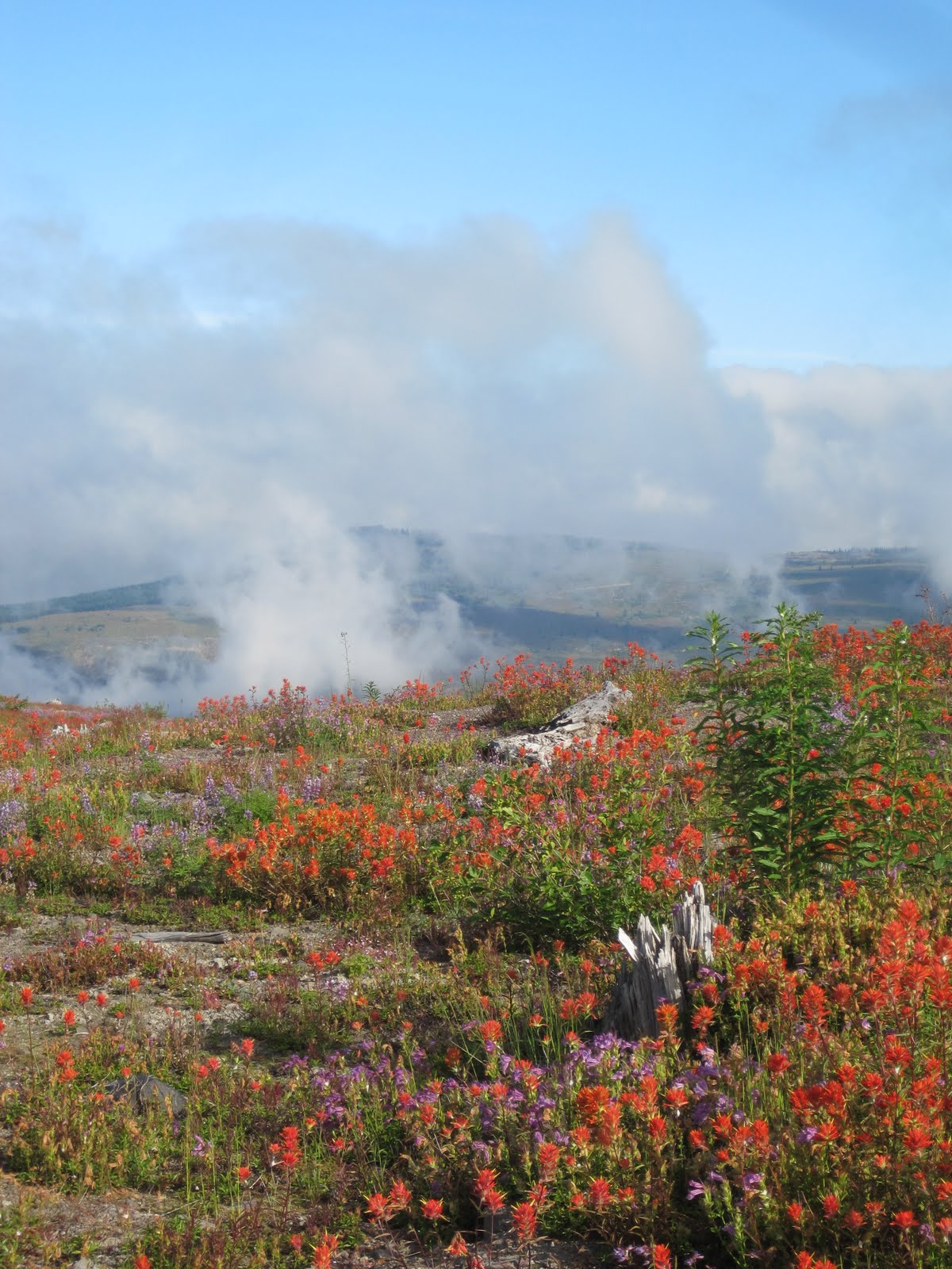
It was a heavy gray overcast morning in the lowlands and as I passed into a huge fog / cloud bank on the way up I wondered if I was going to be skunked. But as quickly as the fog bank enveloped me, I gained enough altitude to come out on the upper side with mixed clouds and sun.
This is the view up the valley through the area known as The Hummocks. You can see the Toutle River cutting its way through the mud flow. The biggest change from when I was last here, aside from the dome inside the crater, is that the dominant color is green.

Johnson Ridge is named after Dave Johnson's, a Geologist sitting watch who famously reported "Vancouver Vancouver This is it!" as he witnessed the eruption which took his and 56 other lives. The Visitors Center sits directly across from the crater opening and right on the edge giving you the view across the devastation and rebuilding.


I wandered about enjoying the solitude and the lovely examples of early vegetation. These flowers have repopulated naturally. The whole monument is one large science lab of discovery. Blasted stumps show the force and power.


Dominant flowers are Indian Paintbrush ( red) Lupins ( blue) and Cardwells Penstemon

This bare slope certainly gives you a lot of information. The remaining logs show you the direction of the blast. The ruts show you where downed trees, since rotted away have left impressions further channeling water to groove the soil.

On a north facing slope these odd mushrooms are likely thriving on log buried, rotting wood.

To the north and east the Coldwater Ridge shows the effect of loss of trees, the addition of the ashy layer and the odd pattern of runoff scars.

The eruption created, and destroyed, several lakes. Coldwater Lake has become a popular fishing destination. The boardwalk out onto the lake shows water as clear as glass. The fishermen in their little boats were not in a chatty mood. I wanted to ask about the clarity further out.

I was happy to be able to capture one oddity, which showed up well on my picture. In 1983 many of the hills surrounding the monument were replanted with Nobel Fir. This has led to an odd and interesting effect. The trees are monoculture, all from nursery stock and all highly uniform. The visual effect is some odd double vision blurring. Look closely, each one uniform and so like the next. I suspect before long, storms and time will take their toll and other trees will creep in and get hold. Will this land eventually be harvested , or was it determined that this tree species is the one most likely to do well in this unique soil system. I really don't know.

The Wikipedia entry for Mt St Helen's is well done. There are lots of good links and photos. Please pay a visit.
http://en.wikipedia.org/wiki/Mount_St._Helens

I hit the road home early. I-5 northbound especially between Olympia and Seattle is MISERABLE on Sundays. No matter what happy times you had in the day, the traffic is sure to harsh that happy. I decided that I would take the back road, Hwy 507 from Centrallia to Puyallup then up the Valley Freeway to Hwy 18 . Cut over to North Bend and get home via the backdoor.
At noon I got to the coffee stand in Centrallia, where the young barista (and former commuter to Tacoma for college, poor kid) approved of my plan. I heard on the radio that traffic was already backed up at the Nisqually River.
By the time I got to the backside of Joint Base Lewis and McCord the I-5 Freeway backup was about 8 miles...then 10 miles. I shook my head in pity over those folks and smiled at my good plan. I knew the core of Seattle was no better with the I-90 bridge closed and people out enjoying the rare perfect 75 and sunny day.
I got to North Bend in three hours!!! That is a huge record for this drive and I will use this back road to happily meander home when I am in the south and west
Just fascinating to see the results of that eruption.
ReplyDeleteI hope to visit here some day. It must be just so impressive to see in person.
ReplyDeleteEllen you really must, both sides.
ReplyDeletethe climb is relativly easy ( Monitor Ridge to top ) You would have no trouble with it.